
How 3D Drone Mapping Speeds Up Construction Planning and Monitoring
In construction, time is money. Delays can mean missed deadlines, higher costs, and frustrated clients. That is why many builders are turning to 3D mapping drone technology. It offers faster, more accurate site data that can be used immediately for planning and progress tracking.
The ability to capture a detailed map of a job site in hours instead of days is changing how teams work. With the growing demand for drone services in Austin, more projects are now benefiting from quicker planning and real-time updates.
What is 3D Drone Mapping and Why It Matters
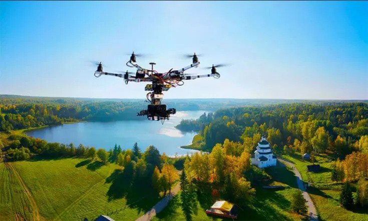
A 3D mapping drone uses high-resolution cameras and sensors to capture multiple images from above. These images are processed into a detailed, three-dimensional model of the site.
This model is not just a pretty picture. It contains accurate measurements, elevation data, and spatial information. Teams can use it to plan layouts, measure distances, and monitor progress without physically walking the entire site. This saves time and reduces safety risks.
Speeding Up Initial Planning
In the early stages of construction, accurate site data is crucial. Traditional surveying methods can take several days and often require multiple people on-site. A 3D mapping drone can collect the same data in a single flight.
This speed means architects, engineers, and project managers can start working on designs much sooner. For developers in Texas, using drone services in Austin ensures they have timely, reliable data to keep projects moving forward without unnecessary delays.
Improving Accuracy for Better Decisions
Faster data collection does not mean sacrificing quality. The models created from drone mapping are highly accurate and can be updated regularly. This ensures decisions are based on the latest site conditions.
For example, if a grading project changes the land contours, a quick drone flight can capture the updated terrain. This helps avoid costly mistakes like pouring foundations in the wrong spot or ordering materials in incorrect quantities.
Monitoring Progress with Ease
One of the biggest benefits of 3D mapping drone technology is how it simplifies progress tracking. Instead of relying on manual inspections alone, teams can use updated maps to see exactly what has been completed.
This is especially helpful for large or complex projects. Managers can compare the current site model to earlier versions, spotting changes and identifying areas where work is ahead or behind schedule. It keeps the entire team informed without endless site visits.
Enhancing Safety on Construction Sites
Construction sites can be hazardous, especially in areas with unstable terrain or ongoing heavy equipment use. A drone can capture the necessary images without putting people in risky positions.
In addition, drone services in Austin often combine mapping with aerial photography for safety inspections. This makes it possible to monitor dangerous areas and plan safer access routes before sending in workers.
Reducing Costs Through Efficiency
Saving time naturally reduces labor costs. Fewer hours spent on surveying means workers can focus on other tasks. The ability to spot potential issues early also prevents expensive rework.
For example, detecting grading errors before concrete is poured can save thousands of dollars. The consistent, reliable data from a 3D mapping drone helps prevent such problems from going unnoticed until it is too late.
Keeping Stakeholders Informed
Clients, investors, and city officials all want updates on project progress. With 3D drone mapping, sharing those updates is simple. The visual models are easy to understand, even for people without technical backgrounds.
This clear communication builds confidence. When stakeholders can see the site from above and understand the changes, they are more likely to trust the project is on track.
Why Austin is Adopting Drone Mapping Quickly
The rapid growth in construction across Austin makes speed and efficiency more important than ever. From new residential developments to commercial complexes, the demand for accurate, timely site data is constant.
By using drone services in Austin, builders can manage projects more effectively. The city’s mix of urban and suburban construction sites makes drone mapping an ideal solution for both tight spaces and large open areas.
Final Thoughts
3D mapping drone technology is transforming the way construction projects are planned and monitored. By delivering accurate, high-resolution site data quickly, it shortens timelines, improves safety, and reduces costs.
In a competitive market like Austin, working with experts in drone services in Austin ensures projects stay on schedule and within budget. The ability to see the site clearly, plan with confidence, and monitor progress in real time is no longer just an advantage—it is becoming a necessity for successful construction.