Different Types of Land Registry Plans
Whether you’re buying land, registering property boundaries, or preparing for a major construction project, precise data ensures smooth legal, technical, and financial processes. Two critical tools in achieving this precision are Land Registry Plans and Point Cloud Laser Scanning services. While the former provides a legal framework, the latter brings cutting-edge technology to mapping and surveying. Together, they form the backbone of reliable property documentation and planning.
What Are Land Registry Plans?
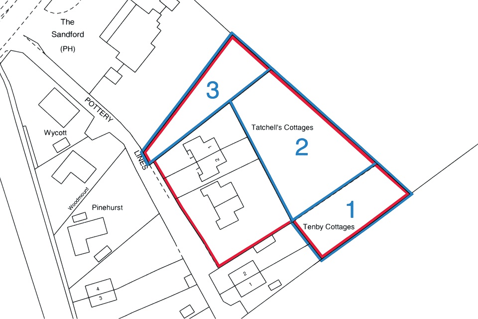
A Land Registry plan is an official document that outlines the boundaries and features of a property or land parcel. It is required when registering land or property with the Land Registry, especially during transactions, leases, or subdivision of plots. These plans are legally recognised and provide clarity in case of disputes or development proposals.
Types of Land Registry Plans
Title Plans
Title plans are the most common type used in property ownership. They show the general boundaries of a property as recorded in the Land Registry. Title plans include details such as the property’s location, outline, and sometimes adjacent roads or landmarks for context. These plans are considered most beneficial while buying property or resolving boundary disputes.
Lease Plans
Lease plans are required when a property or part of it is leased for a term exceeding seven years. These plans show the area of the lease covering the entire property, including shared access areas, car parks, and pathways. They must meet strict Land Registry requirements, such as being drawn to scale and showing north orientation.
Transfer Plans
Transfer plans are used during the sale or transfer of part of a property. They clearly define the portion of land being transferred, ensuring both parties and the Land Registry understand the boundaries of the new ownership.
Boundary Plans
Boundary plans focus on precisely defining the location of property lines. Often used in disputes or when clarifying rights of way, these plans provide more detailed information than standard title plans.
Subdivision Plans
When large plots of land are divided into smaller parcels for sale or development, subdivision plans are implemented. They show how the original property will be split and are essential for developers and planners.
Why Accuracy Matters in Land Registry Plans
Inaccurate or poorly prepared plans can lead to legal disputes, delays in registration, and costly errors during construction or development. Land Registry requirements are stringent to avoid ambiguities. This is where modern surveying technologies, such as Point Cloud Laser Scanning, are proving to be transformative.
What Is Point Cloud Laser Scanning?
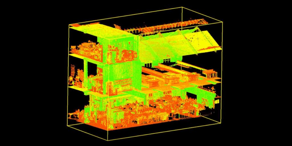
Point Cloud Laser Scanning is a method of capturing high-precision 3D data of physical environments using laser technology. The scanner emits laser beams that bounce back from surfaces, recording millions of data points that form a “point cloud.” This data can then be used to create detailed 3D models, 2D plans, or even virtual walkthroughs of buildings and land.
Importance of Point Cloud Laser Scanning Services
Exceptional Accuracy and Detail
Traditional surveying methods, while effective, can be time-consuming and prone to human error. Point Cloud Laser Scanning offers sub-millimetre accuracy, capturing even the most complex site features. This is crucial for creating Land Registry plans that meet legal standards.
Efficiency in Data Collection
Laser scanning collects vast amounts of data in a fraction of the time it takes traditional surveys. This means faster turnaround times for clients, allowing property transactions and development projects to proceed without unnecessary delays.
Versatility Across Projects
Whether you’re working on residential property boundaries, heritage site restoration, or large infrastructure projects, Point Cloud data is adaptable. It provides a foundation for architects, engineers, and legal professionals to work with confidence.
Enhanced Visualisation and Planning
The 3D models created from point clouds allow stakeholders to visualise the property or land in detail. This is especially valuable in urban planning, where understanding the relationship between buildings, terrain, and infrastructure is critical.
Support for BIM (Building Information Modelling)
In construction, Point Cloud data integrates seamlessly with BIM systems, enabling better design, clash detection, and construction sequencing.
Conclusion:
As property transactions and developments become more complex, the need for precision in surveying has never been greater. The Land Registry plans provide the legal foundation for property ownership, while Point Cloud Survey London introduces technological innovation to surveying, ensuring unparalleled accuracy and efficiency.
Investing in professional services for both buying and selling, as well as for development and dispute resolution, not only saves time and reduces errors but also protects your interests in the long run. For anyone navigating property in today’s fast-paced environment, these tools are no longer optional—they’re essential.